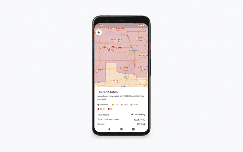
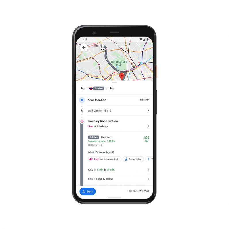
To help you with that, Google Maps is rolling out new information related to COVID-19 in a particular area. The app will now display the total number of cases and deaths till now and a 7-day trend indicating if the numbers are going up or down. Plus, you’ll also get to access local guidelines, restrictions, and information related to testing centers. This will help you make a decision if you want to cancel or postpone your trip. In August, the company rolled out a feature that lets you find hotels allowing free cancelation during the pandemic. Later in September, Google introduced a COVID-19 layer in Maps to assist people in finding containment zones. [Read: Neural’s market outlook for artificial intelligence in 2021 and beyond] Google Maps is also rolling out its crowdedness feature worldwide to indicate congestion on a public transport ride. This information is based on real-time input from app users onboard a train or a bus. It’ll help you avoid a particular ride and catch the next one to maintain social distancing. Both features are rolling out to Android and iOS Maps users globally in the coming weeks.